Thingiverse
Elevation Model
by JustinSDK
15
Downloads
25
Likes
0
Makes
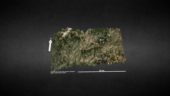
I wrote a script to generate OpenSCAD source code from elevation data. Here's a demonstration. The featured image shown here is [Taiwan](https://www.google.com.tw/maps/place/%E5%8F%B0%E7%81%A3/@23.6558232,120.3439706,8.04z/data=!4m5!3m4!1s0x346ef3065c07572f:0xe711f004bf9c5469!8m2!3d23.69781!4d120.960515), generated from data that latitude from 21.75 to 25.500 and longitude from 119.900 to 122.100.
If you want to generate your own one, see [elevation2scad](https://github.com/JustinSDK/elevation2scad) for details.
If you want to generate your own one, see [elevation2scad](https://github.com/JustinSDK/elevation2scad) for details.
JustinSDK also publishes on
4 additional models across 1 more platforms
Did you print this model? Sign in and share your make!
Sign in to leave a comment
Sign inNo comments yet – be the first!