MakerWorld
Architecture
Ver Modelo
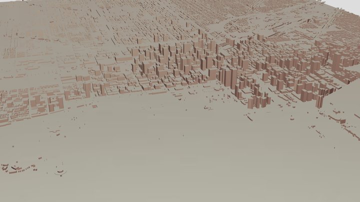
The Loop - Chicago
27
Descargas
23
Likes
7
Makes
A 3D map of the Chicago neighborhood The Loop. The map contains Google Maps data from South Branch Chicago River (West) to the South Michigan Avenue (East), and from West Lower Wacker Drive (North) to West Ida B. Wells Drive (South). The map displays a 1.2km x 1.3km area.Terrain/surface highlighted in white materialBodies of water is highlighted in light blue material (black in photographed print)Parks, greenery, and athletic complexes found in Maps data highlighted in green materialBuildings, streets, walkways, and service roads are highlighted in black materialPhotographed print created using X1C with accompanying AMS. It has standard Grid infill, 15%. The print is 6" x 5.5".The initial layer as well as all other layers are 0.2mm thick. This can be adjusted, however I have yet to test other layer heights. Model largely created in Blender via Blosm.
¿Has impreso este modelo? Inicia sesión y comparte tu make.
Inicia sesión para dejar un comentario
Iniciar sesiónAún no hay comentarios – ¡sé el primero!